# Geography Now! MAURITIUS
Geography is an important subject that many people are interested in learning about, and today we’re diving deep into one of the Indian Ocean’s most fascinating island nations – Mauritius. This small but incredibly diverse country offers a perfect case study in how geography shapes culture, economy, and daily life. Located approximately 2,000 kilometers east of Madagascar and 900 kilometers east of Réunion, Mauritius stands as a testament to how isolated island nations can thrive through strategic positioning and natural beauty.
## Understanding the Basics
Mauritius is a volcanic island nation that emerged from the depths of the Indian Ocean millions of years ago. The main island, also called Mauritius, covers approximately 1,865 square kilometers and is home to over 1.2 million people. What makes this island particularly fascinating from a geographical perspective is its unique formation and the way human settlement has adapted to its natural features.
The island’s landscape is dominated by a central plateau that rises to about 600 meters above sea level, surrounded by coastal plains and dramatic mountain ranges. The highest peak, Piton de la Petite Rivière Noire, reaches 828 meters and offers breathtaking views of the surrounding terrain. This varied topography creates distinct microclimates across the relatively small landmass, with the central highlands receiving significantly more rainfall than the coastal areas.
Mauritius’s strategic location has made it a crucial waypoint for maritime trade routes connecting Asia, Africa, and Europe. This positioning has profoundly influenced the island’s cultural development, creating a unique melting pot of African, Indian, European, and Chinese influences that is reflected in everything from architecture to cuisine.
## Key Methods
### Step 1: Exploring the Volcanic Origins
Understanding Mauritius begins with recognizing its volcanic heritage, which continues to shape both its physical landscape and human activities. The island formed through a series of volcanic eruptions that occurred over millions of years, creating the foundation for its current geography. These volcanic origins are still visible today in various formations across the island, including the famous Trou aux Cerfs crater in Curepipe and the dramatic basaltic cliffs along the southern coast.
The volcanic soil that resulted from these ancient eruptions has proven to be incredibly fertile, making agriculture one of Mauritius’s primary economic activities. Sugar cane cultivation, which was introduced during the colonial period, thrives in these rich soils and continues to dominate large portions of the landscape. The flat coastal plains, formed by ancient lava flows, provide ideal conditions for large-scale agricultural operations.
The island’s geological structure also influences its water resources. The porous volcanic rock acts as a natural filter system, creating numerous underground aquifers that supply fresh water to the population. This natural water storage system is crucial for an island nation with limited surface water sources, though it also makes the groundwater vulnerable to contamination from agricultural runoff and urban development.
### Step 2: Climate Patterns and Seasonal Variations
Mauritius experiences a tropical oceanic climate that is heavily influenced by its position in the Indian Ocean and the surrounding trade wind patterns. The island has two distinct seasons: a warm, humid summer from November to April, and a cooler, drier winter from May to October. However, these seasonal patterns vary significantly across different parts of the island due to topographical differences.
The central plateau and mountainous regions receive substantially more rainfall than the coastal areas, creating a rain shadow effect that results in semi-arid conditions along parts of the western and northern coasts. This variation in precipitation patterns has led to different agricultural practices and settlement patterns across the island. The wetter central regions are ideal for sugar cane cultivation and vegetable farming, while the drier coastal areas have been developed primarily for tourism and residential purposes.
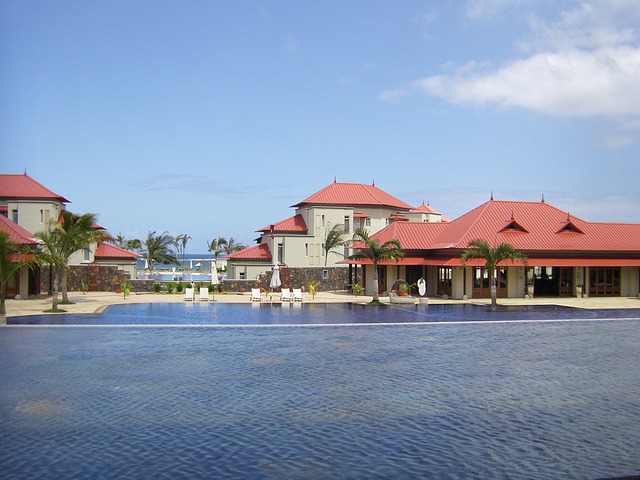
Mauritius is also situated within the cyclone belt of the South-West Indian Ocean, making it vulnerable to tropical cyclones between November and May. These weather events have shaped both the natural landscape and human adaptation strategies. Traditional architecture incorporates features designed to withstand strong winds, and modern building codes reflect the need to prepare for extreme weather events. The cyclone season also influences tourism patterns and agricultural planning throughout the island.
### Step 3: Cultural Geography and Population Distribution
The human geography of Mauritius is as diverse as its physical landscape, reflecting centuries of migration and cultural exchange. The population is remarkably heterogeneous, with people of Indian, African, European, and Chinese descent living together in a relatively harmonious multicultural society. This diversity is not randomly distributed across the island but follows distinct geographical patterns that reflect historical settlement processes and economic opportunities.
Port Louis, the capital and largest city, serves as the primary commercial and administrative center, housing approximately 150,000 people in the urban core and over 600,000 in the greater metropolitan area. The city’s location in a natural harbor on the northwest coast made it an ideal choice for the colonial capital, and it continues to serve as the main port and economic hub. The surrounding Plaines Wilhems district has become the most densely populated area of the island, hosting several major towns including Beau Bassin-Rose Hill, Quatre Bornes, and Vacoas-Phoenix.
Rural areas maintain distinct cultural characteristics that often correlate with geographical features and historical land use patterns. Villages in the central plateau tend to have stronger connections to agricultural traditions, while coastal communities have developed around fishing, tourism, or port activities. This geographical distribution of cultural communities has created a unique situation where different ethnic and religious groups maintain their distinct identities while participating in a shared national culture.
## Practical Tips
**Tip 1: Understanding Regional Climate Variations**
**Tip 2: Exploring Geological Features Safely**
Mauritius offers numerous opportunities to explore its volcanic heritage, from hiking crater rims to visiting lava tube caves. However, tropical weather can make rock surfaces slippery and dangerous. Always use proper footwear, carry sufficient water, and consider hiring local guides who understand the terrain. The Black River Gorges National Park provides excellent examples of native flora adapted to volcanic soils, but trails can be challenging during wet season.
**Tip 3: Navigating Cultural Geography**
The multicultural nature of Mauritius means that different areas of the island may have distinct cultural atmospheres, festivals, and even languages spoken. Tamil, Hindi, Creole, French, and English are all commonly heard, and religious festivals from various traditions occur throughout the year. Research local customs and festivals before visiting different regions to enhance your cultural understanding and show appropriate respect.
**Tip 4: Transportation and Island Geography**
The island’s road network follows the natural topography, with main routes connecting coastal towns and mountain passes providing access to the central plateau. Traffic patterns reflect both geography and economic activity, with heavy congestion around Port Louis during business hours and increased traffic to tourist areas during peak seasons. Plan travel times accordingly and consider the scenic routes through the mountains for a better geographical perspective.
**Tip 5: Marine Geography and Water Activities**
## Important Considerations
When studying or visiting Mauritius, it’s crucial to understand the environmental challenges facing this island nation. Climate change poses significant threats to low-lying coastal areas, coral reef systems, and water resources. Rising sea levels could impact the tourism infrastructure that lines much of the coast, while increasing ocean temperatures threaten the coral reefs that protect the shoreline and support marine biodiversity. Additionally, more intense cyclones could become more frequent, requiring ongoing adaptation in building practices and emergency preparedness.
The island’s rapid development has also created environmental pressures that visitors and researchers should be aware of. Coastal development for tourism has sometimes conflicted with natural ecosystem preservation, and the limited land area means that waste management and water resource protection are ongoing challenges. Understanding these issues helps visitors make more responsible choices and appreciate the delicate balance between development and conservation that Mauritius must maintain.
## Conclusion
Mauritius stands as a remarkable example of how geography shapes every aspect of a nation’s character, from its dramatic volcanic landscapes to its vibrant multicultural society. The island’s position in the Indian Ocean has made it a crossroads of cultures while its natural beauty has made it a sought-after destination for travelers from around the world. Understanding the geographical foundations of Mauritius – its volcanic origins, diverse climate patterns, strategic location, and unique ecosystems – provides insight into how small island nations can thrive despite challenges of isolation and limited resources.
For geography enthusiasts, Mauritius offers endless opportunities to observe how natural processes and human activities interact to create distinctive landscapes and cultures. Whether you’re interested in volcanic geology, coral reef ecosystems, tropical agriculture, or multicultural societies, this island nation provides compelling examples of geographical concepts in action. The key to truly appreciating Mauritius lies in recognizing how its past volcanic activity, current climate patterns, and strategic oceanic location continue to influence everything from where people live to what they eat, creating a living laboratory for geographical study that rewards careful observation and cultural sensitivity.